Use APKPure App
Get TotalMapper old version APK for Android
Maps and navigation + MTB, hiking and skiing routes of Slovakia
Map and navigation application with many functions for all mountain activities. The application can work with GPS devices and smart watches such as Garmin, etc. Integrated MTB - VHT - SKIALP guide:
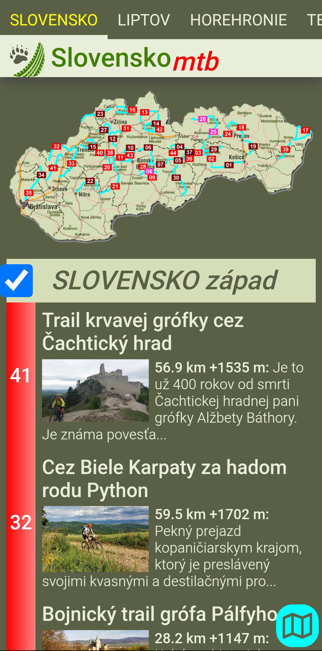
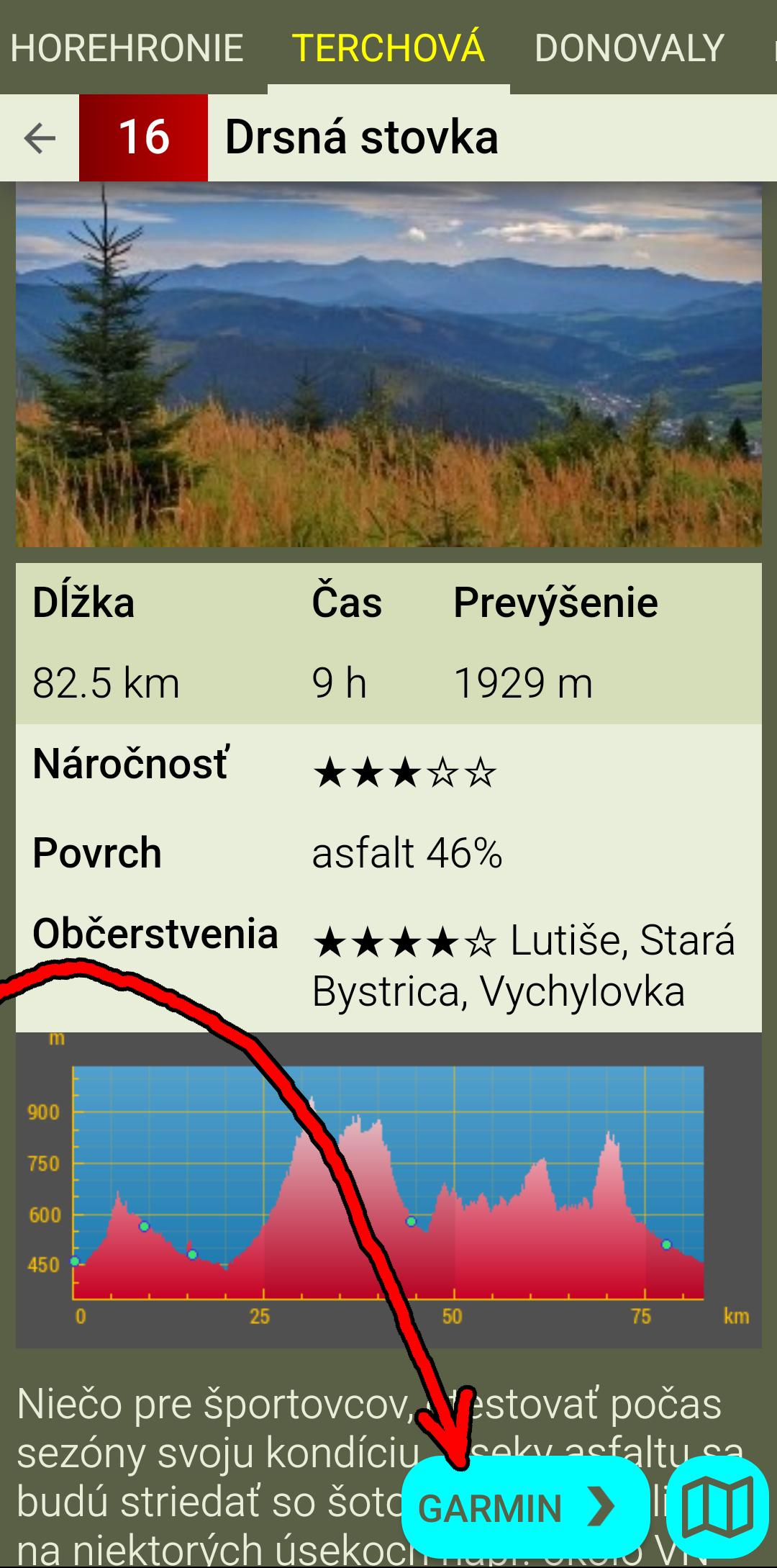
- descriptions of MTB routes within Slovakia.
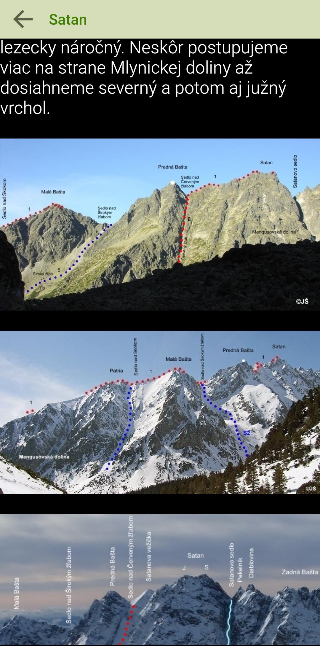
- descriptions of Tatra hikes on the border between hiking and mountaineering.
- descriptions of Tatra ski mountain tours.
MAPS
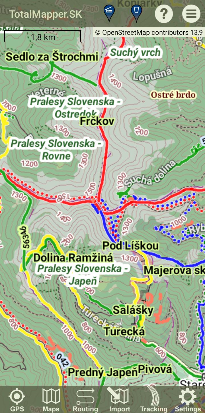
There are many maps of the world based on OSM. All maps can be downloaded offline, thus gaining independence from the Internet. It is possible to adjust the font size for the mobile screen and visual disposition of the user. Of course, the choice of map orientation is also in the direction of travel or according to the compass.
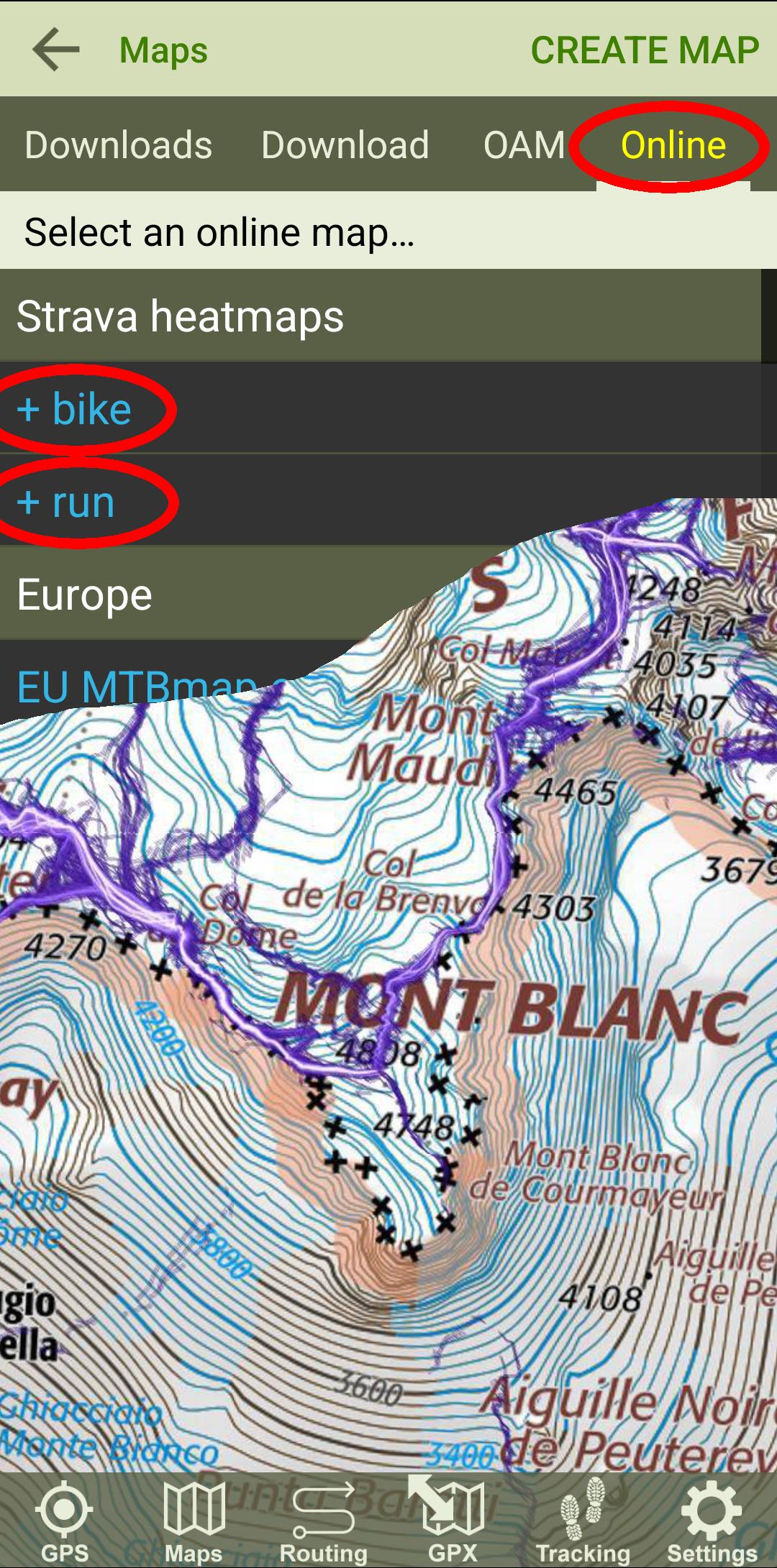
The latest versions allow you to use Strava heatmaps as a map layer, which opens up new possibilities for planning and finding the optimal route.
The following maps are currently available for selection:
Europe
EU Freemap.sk/cyclo
EU Freemap.sk/tourist
CZ Cykloserver.cz
ES IGN.es
FR BRGM.fr
FR IGN.fr
SK Cykloserver.cz
SK NLC.sk/forest roads
World
WW BergFex.at
WW Cykloserver.cz
WW Mapy.cz
WW OpenCycleMap.org
WW OpenStreetMap.org
WW OpentTopoMap.org
IL IsraelHiking.il/hiking
IL IsraelHiking.il/mtb
NZ NZTopoMaps.com
Strava heatmaps
WW Strava/bike
WW Strava/run
OpenAndroMaps
WW vector maps
NAVIGATION
The application provides all the functions you need in the terrain, including voice navigation and tracking progress according to the height profile.
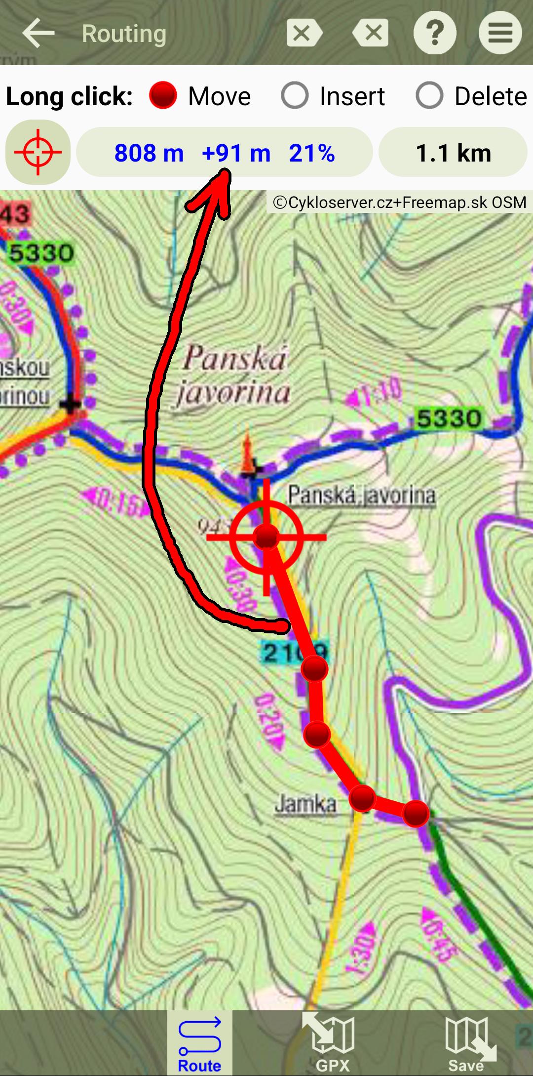
ROUTING - route planning + GPX editor
It searches for a route from point A to point B with the choices ROAD - MTB - HIKE - RUN. The route is calculated on the OpenStreetMap or MapQuest servers. It is also possible to use the comfortable GPX editor and click or edit your own route. A height profile is automatically generated. Distance and slope can be measured.
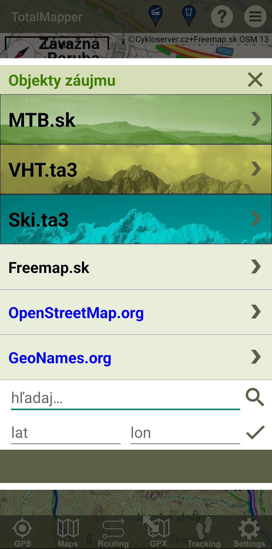
OBJECTS - points of interest
The application can display various types of objects on the map, such as accommodation and restaurant facilities, water sources, cultural and historical objects, etc.
TRACKING - route recording
The application records the route traveled. In addition to GPS coordinates, the recording also contains information about time and altitude. It is possible to add your own points on the route (so-called trackpoints) to the record, which in addition to the name, can also contain photos.
DASHBOARD
It is possible to call up a Dashboard with similar functions as a cycle computer:
- total time
- distance traveled
- climbed height meters
- height above sea level
- maximum altitude
- instant, maximum and average speed
MAP PORTALS AND SOCIAL NETWORKS
The application accepts the GPX format, which is supported by all well-known web map portals. It can be used when planning a route, as well as viewing a recorded route. The application is able to share traveled routes on social networks such as FB, Strava, etc.
Last updated on May 23, 2024
Minor bug fixes and improvements. Install or update to the newest version to check it out!
Latest Version
![]() 3.5.2
3.5.2
Requires Android
6.0
Available on
![]()
Category
Report

Discover what you want easier, faster and safer.

TotalMapper
3.5.2 by Miroslav Langer
May 23, 2024
$4.49