Use APKPure App
Get Geotag Location, Map, Compass On Photo old version APK for Android
Geotag Location, Map, Compass on photo [GPS Camera Stamp]
Features of GPS Map Camera: Geotag Photo & GPS Location:
GPS location,
compass direction
altitude,
date & time
map screnshot,
sunrise sunset ,
sun moon locator
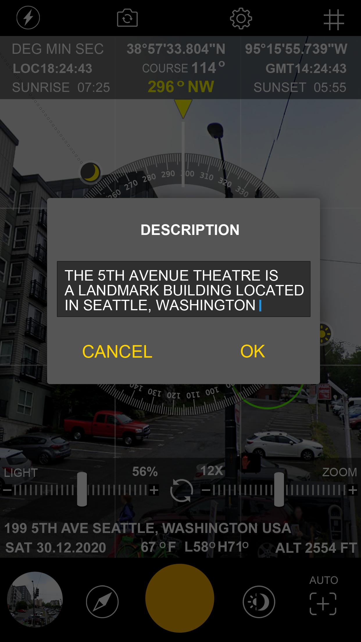
notes such as project name and photo description
Interesting Features of GPS Map Camera: Geotag Photo & GPS Location:
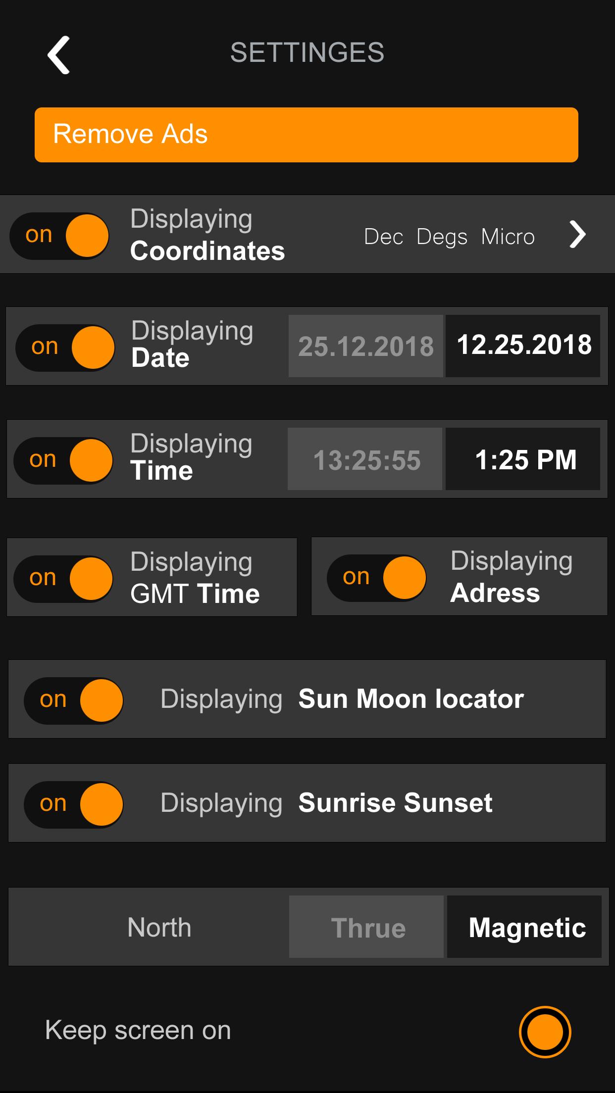
Coordinate types:
- Dec Degs (DD.dddddd˚)
- Dec Degs Micro (DD.dddddd "N, S, E, W")
- Dec Mins (DDMM.mmmm)
- Deg Min Secs (DD°MM'SS.sss")
- Dec Mins Secs (DDMMSS.sss")
- UTM (Universal Transverse Mercator)
Time Format:
24 Hours / 12 Hours
Date Format:
DD/MM/YYYY , MM/DD/YYYY , YYYY/MM/DD
Camera features:
Flash - Focus - Rotate
Units:
Meters / Feet
Directions:
True North / Magnetic North
Last updated on Feb 22, 2021
App Release
Latest Version
![]() 1.0
1.0
Uploaded by
Haider Ali
Requires Android
Android 5.0+
Category
Report


Discover what you want easier, faster and safer.

Geotag Location, Map, Compass On Photo
1.0 by DINGO
Feb 22, 2021