Use APKPure App
Get GPS Map Ruler old version APK for Android
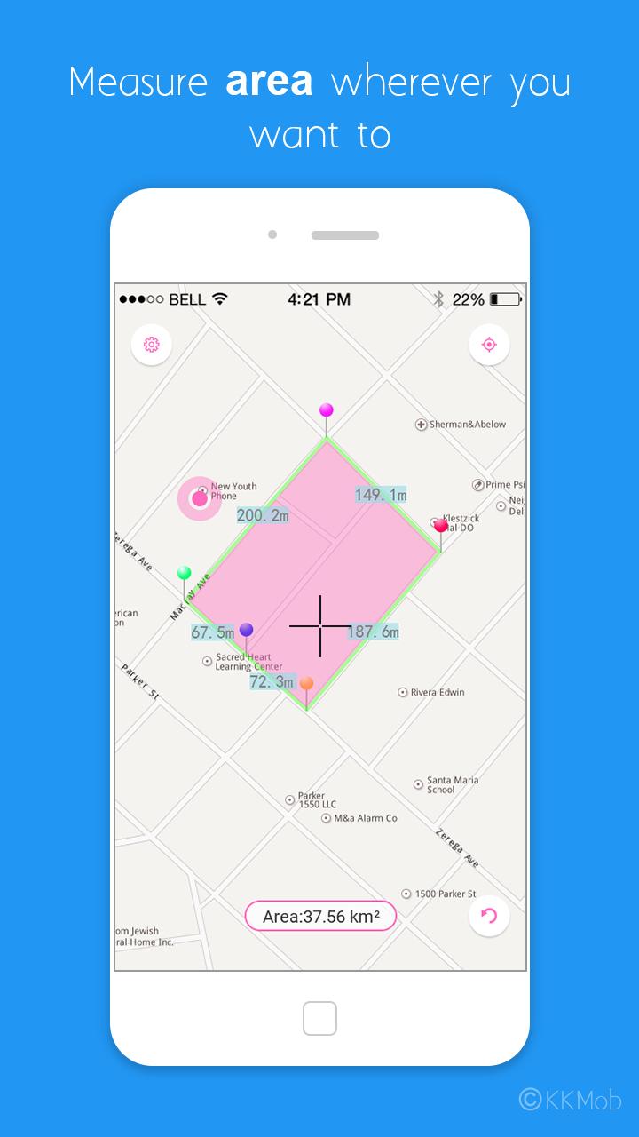
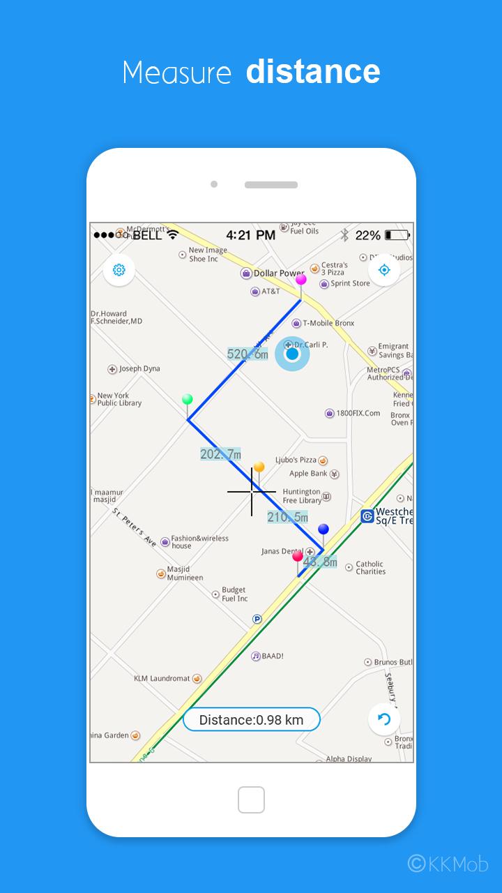
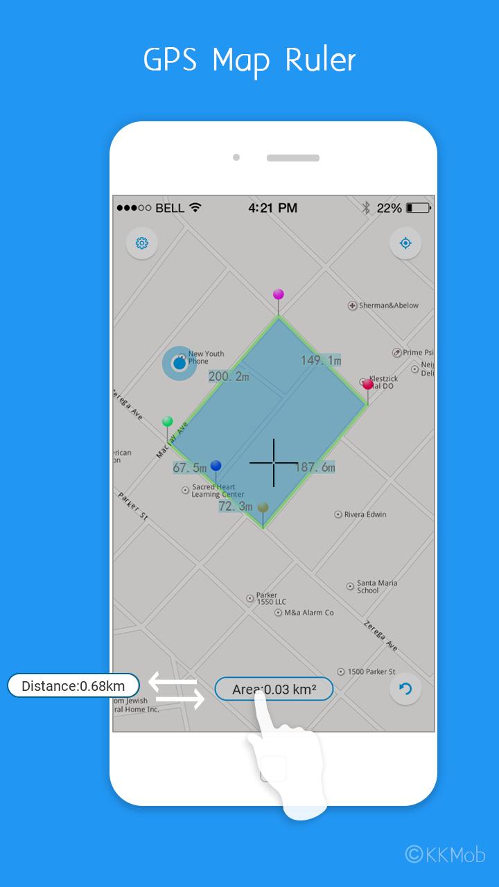
Measure distance & area on the map.
GPS Map Ruler can help you measure distance & area.
GPS Map Ruler Important features:
1. Measure distance on the map
2. Measure area
3. 2 themes (Azure & Pink)
4. Supports multiple length units (Meter, Kilometer, Mile, Inch, Foot, Yard)
5. Supports multiple area units (Square meter, Square kilometer, Square mile, Square Inch, Square Foot, Square Yard, Hectare, Acre)
6. Supports multiple map types (Standard, Satellite, Mix Mode)
7. GPS Map Ruler is free now!
How to use GPS Map Ruler?
1. Tap the mid-bottom button to switch between distance & area
2. Tap the right-bottom button to undo, long press undo button to clear all point on the map.
3. Tap the right-top button to move to your current location.
If you have any questions about using GPS Map Ruler, please e-mail us.
Thanks.
Last updated on May 29, 2017
V2.7.0
Add supports for larger aspect ratio device (Samsung Glaxy S8 and LG G6)
V2.6.0
1. Fix crash bug
2. Fix satellite map & mix mode map bug
3. Fix to my location bug
Add translate
Latest Version
![]() 2.7.0
2.7.0
Uploaded by
Ezra Mona
Requires Android
Android 2.3.2+
Category
Report


Discover what you want easier, faster and safer.

GPS Map Ruler
2.7.0 by KKMob
May 29, 2017