Use APKPure App
Get Map of Assam(India) old version APK for Android
Map of Assam(India)
Map of Assam(India)
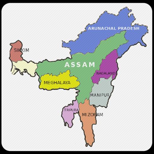
Assam is a state in India, situated south of the eastern Himalayas along the Brahmaputra and Barak River valleys. Assam covers an area of 78,438 km2 (30,285 sq mi). The state is bordered by Bhutan and the state of Arunachal Pradesh to the north; Nagaland and Manipur to the east; Meghalaya, Tripura, Mizoram and Bangladesh to the south; and West Bengal to the west via the Siliguri Corridor, a 22 kilometres (14 mi) strip of land that connects the state to the rest of India.
All of information taken from wikipedia.
Last updated on Feb 23, 2019
Minor bug fixes and improvements. Install or update to the newest version to check it out!
Latest Version
![]() 1.0
1.0
Requires Android
4.0.3 and up
Category
Report

Discover what you want easier, faster and safer.

Map of Assam(India)
1.0 by developerpassions
Feb 23, 2019