Use APKPure App
Get Mumbai Railway Map HD old version APK for Android
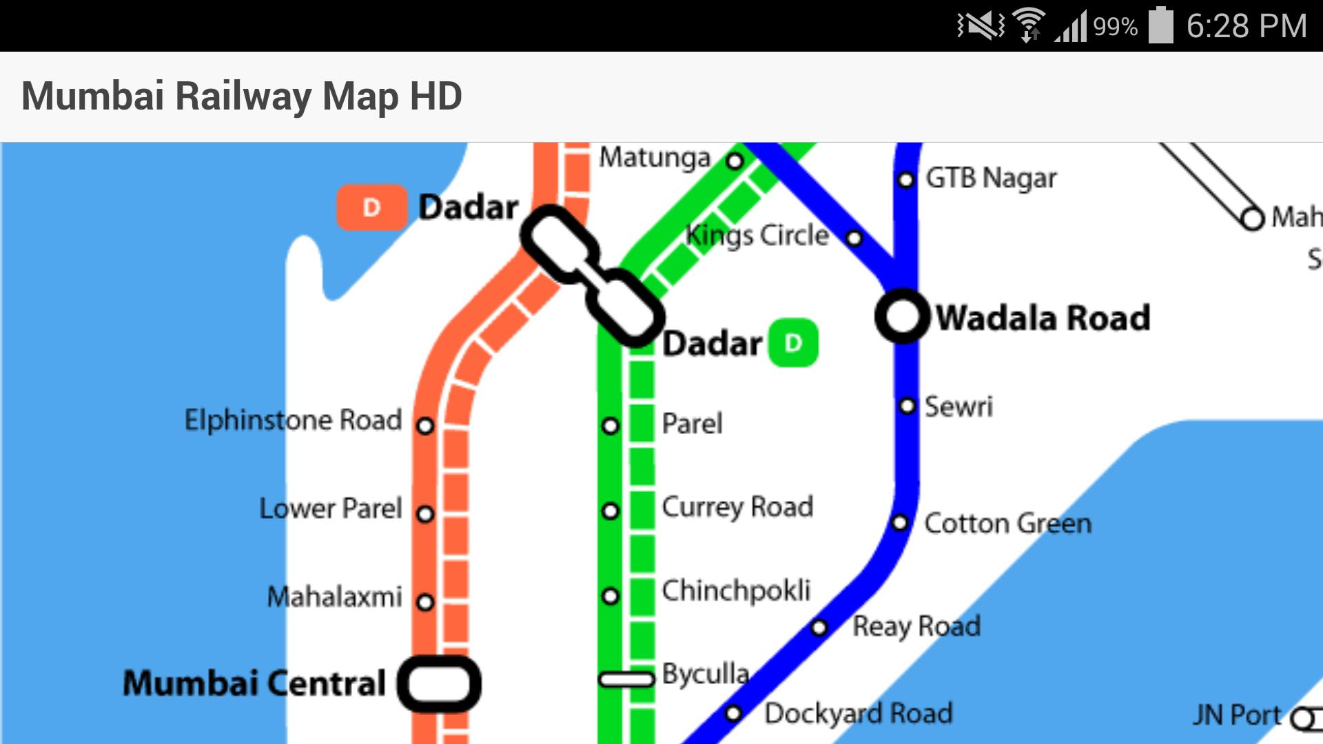
Mumbai Railway Map along with all the stations and joining lines in HD.
Mumbai Local Railway Map or Mumbai Local Train App is a simple app which will help users to view the entire railway network of Mumbai. It will be helpful to both the local commuters and tourists. This Mumbai Local Train Map is available in High Definition so that it is easy to view the map in high as well as low resolution devices.
It covers the following lines:
**WESTERN**
Churchgate - Virar (Fast)
Churchgate - Borivali (Slow)
Virar - Dahanu MEMU Shuttle
**CENTRAL**
Mumbai CST - Kasara / Khopoli (Fast)
Mumbai CST - Kalyan (Slow)
Vasai Road -- Diva
Thane - Navi Mumbai
Nerul / CBD - Uran (Under Construction)
**HARBOUR**
Mumbai CST - Andheri / Panvel
You can use the map to find intermediate lines between Western, Central and Harbour lines. It also includes the map of Pune to Lonavala suburban service as well as the Mumbai Metro Rail map which runs from Versova to Ghatkopar. Currently we don't provide any fares or the local train time table.
Last updated on Aug 16, 2016
Minor bug fixes and improvements. Install or update to the newest version to check it out!
Latest Version
![]() 0.0.1
0.0.1
Uploaded by
Maiquochuy Le
Requires Android
Android 4.1+
Category
Report


Discover what you want easier, faster and safer.


Mumbai Railway Map HD
0.0.1 by VR Technologies
Aug 16, 2016